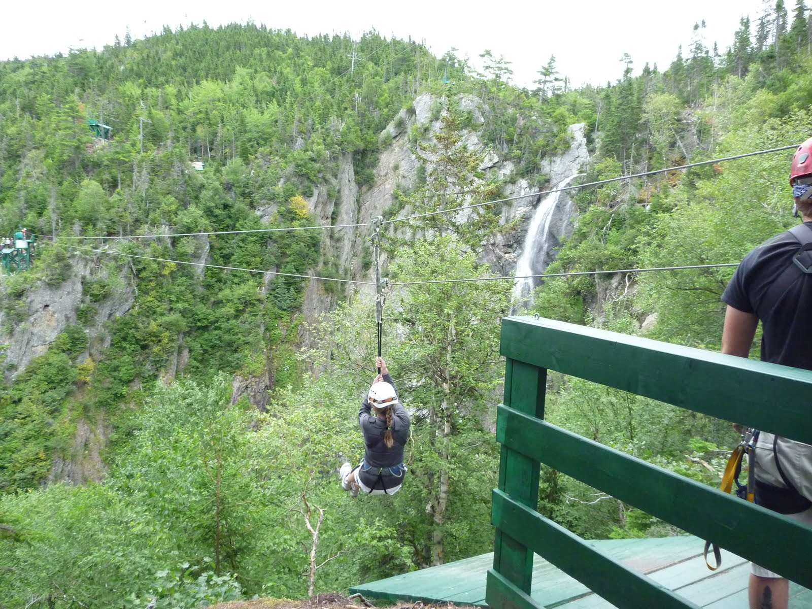
What a rush! There were 8 zips, which took us about 1.5hrs altogether. The highest zip is over 300ft high, and the longest one is 1800ft, where you hit speeds up to 80 km/hr.
The third zip takes you right over a 200ft waterfall. It was amazing!


 The coastline around Isle Aux Morts. Islands, rocks and sunkers everywhere
 So with a new hole in my foot we headed out past the old fish plant. I remember the lovely smell of fish meal that used to come from that place when I was a kid. What a stink!
 Heading out through the eastern passage. I didn't take long before we could feel the swells from outside.
 Going around Potato Island. We were able to catch a few waves along the way, where Potato Island was closest to Little White Island. We could have stayed there surfing all day, but we wanted to explore, so off we went.
 Potato Island to the left, Little White Island to the right
 Facing towards Margaree
 Poking about all the small islands
 One of the very few beaches between Rose Blanche and Port Aux Basques. I didn't even know this one existed. If you look VERY VERY closely to the right above Angie's shoulder, the Caribou is passing by, arriving from Nova Scotia. Even from that far off, we could still hear its engines.
 It looked like a great place to camp, but I don't think there's much beach left at high tide. We stopped here for a short break and a lunch.
 There is a certain smell attached to this type of landscape in the summer time. I can't put my finger on it, but I wish I could bottle it up and take it back to the east coast with me.
 A small channel between two islands
 The water was absolutely still
 Reflections
 Where Isle Aux Morts River meets the sea. Someone has a really nice cabin built in the perfect location. I'm jealous.
 Me with slipway and TravelLift in the background.
 Another short but very nice paddle.
 The SW Coast of Newfoundland, between Isle Aux Mortes and Burnt Islands
 One of the few sensible places to launch along Route 470
 Heading out of God Bay
 Angie paddling past "The Island", which was connected to the mainland by a causeway in 1969
 The site of the old fishplant, it was here in the 1950's
 These are called the Colombier Islands on the map, but everyone home calls the Glumsy Islands, I guess "Colombier" slowly got bastardized to "Glumsy" over the years, haha.
 Happy to be home
 Flat calm inside God Bay
 Under the bridge. I spent a lot of time down here as a kid, it was nice to see it again.