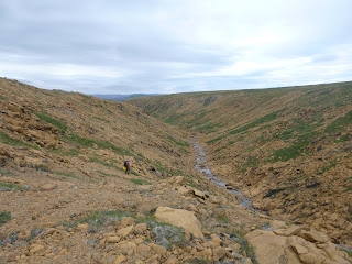
This past Saturday Trent and I finally got to do a paddle we've wanted to do for years, Cape St. Mary's. I've read that there are usually only 1 or 2 days a month that you can do this paddle, due to weather and sea conditions in the area. I don't think there are many areas of the island that are more exposed than this.
I had been watching the weather for a few days and driving home from an evening paddle around Dildo Island with Angie I was trying to figure out where I should go for a day paddle when it hit me, the weather at Cape St Mary's should be perfect. When I got home I double checked the weather and wave forecast from
www.smartbay.ca Less than 1m seas and max wind speed of 8knots. Ideal conditions for this paddle. I called Trent and we were all set to go in the morning.
We were on the water by 9:30am, departing from St. Brides marina.
Almost the entire coast is 200-300ft cliffs with very few landing options.
 |
| The Old Cape Shore |
There were lots of caves, slots and tickles to play around in and explore. Due to the distance we had to cover to get to the Cape, we didn't have a lot of time to explore like we would have liked, but some places we just couldn't resist.
 |
| Slot between Island Head and the mainland |
There were lots of seals hanging out on the rocks along the way. They spook pretty easily and dive into the water as soon as we were in sight of them, so it was hard to get a good picture of anything besides their heads poking out of the water.
 |
| What are you looking at? |
 |
| Cliffs and waterfalls |
 |
| Heading to the Cape. You can see the lighthouse on top |
 |
| Another seal on the way |
 |
| Rounding the Cape. This area is very surly, with shoals and the convergence of currents. Even with seas today at less than 1m, this area was unstable and confused. We stayed very wide! |
 |
| There it is! Bird Rock |
 |
| The bird sanctuary. 30,000 nesting pairs of gannets |
 |
| Several large caves near Bird Rock |
 |
| What a day! |
There were a lot of birds in the air above us, and the noise was deafening. Very impressive sight. I just kept hoping that I wouldn't get shit on. It was falling all around us, but we got through the shit gauntlet unscathed.
 |
| Checking out some caves |
 |
| A slot in the cliffs. Pretty cool |
 |
| Another slot directly opposite the larger one shown above |
 |
| Trent gets close to a seal |
 |
| Our only stop during the 6.5 hr day. Boy did I need to pee at that point! |
 |
| Some seals and a Cormorant (aka Shag) about to take wing |
 |
| Basking seals |
 |
| The largest slot I've ever paddled through, the picture doesn't really show how long it actually was |
 |
| The last cave we checked out on the way back |
So we had a fantastic day on the water. If you go 'point to point' you can reach Bird Rock and back in about 25kms. With the amount of exploring we did along the way it was about 30kms for us and took us 6.5 hrs including our lunch break. Another option is to leave St. Brides and put out at Point Lance, but you would need a car shuttle in this case. The total paddling distance is also about 25kms. If you plan to do this paddle, you have pick your day carefully. The fetch for this area goes from Cape St. Mary's all the way to Brazil, so the seas are nasty here almost all the time, with only 2 or 3 sensible 'bailout' options.


